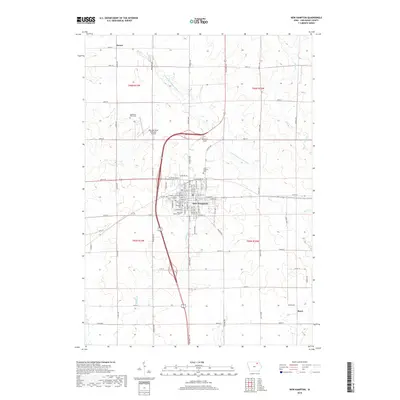
2018 Map of New Hampton
USGS Topo · Published 2018About this map
The agricultural landscape of Chickasaw County is defined by the headwaters of the E Fork Wapsipinicon River and the regional hub of New Hampton. This center of local commerce and government is depicted with a detailed street grid, including E Main St and E Milwaukee St, and is flanked by several significant burial grounds such as New Hampton Cem and Saint Mary's Cem. The map provides a look at the area's rural transportation network and land use, showing the smaller settlements of Devon to the north and Boyd to the southeast. Genealogists will find particular value in the identification of family-named sites like Eggleston Farm Cem and specialized sites like the Children of Israel Cem. Aviation landmarks such as the New Hampton Municipal Airport and Mitchell Field indicate the area's modern infrastructure within a traditionally agrarian setting.
Find a feature on this map
69 named features on this map. Tap any name to fly to it.
Don’t see what you’re looking for? This feature index may not catch every label — zoom into the map to look around manually.
Map Details
Editions of this 2018 New Hampton Map
This is the sole edition of this map. No revisions or reprints were ever made.
Other maps of this area

1954 · Mason City
USGS Topo · 1:250,000

1954 · Waterloo
USGS Topo · 1:250,000

1955 · Waterloo
USGS Topo · 1:250,000

1957 · Mason City
USGS Topo · 1:250,000

1958 · Mason City
USGS Topo · 1:250,000

1971 · Tripoli NW
USGS Topo · 1:24,000

1971 · Fredericksburg
USGS Topo · 1:24,000

1971 · Frederika
USGS Topo · 1:24,000
1972 · Ionia
USGS Topo · 1:24,000

1972 · Elma
USGS Topo · 1:24,000