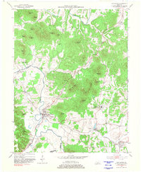
1953 Map of New Haven
USGS Topo · Published 1981About this map
The Abbey of Our Lady of Gethsemani stands as a central landmark in this Nelson County landscape, where the Louisville and Nashville railroad winds through the river valleys. The terrain is defined by a dense network of knobs, including Troutman Knob, Wolf Knob, and the Forty Acre Knobs, which rise sharply above the fertile bottomlands of the Beech Fork and Rolling Fork.
Find a feature on this map
51 named features on this map. Tap any name to fly to it.
Don’t see what you’re looking for? This feature index may not catch every label — zoom into the map to look around manually.
Map Details
Editions of this 1953 New Haven Map
4 editions found
Other maps of this area

1949 · Cravens
USGS Topo · 1:24,000

1949 · Shepherdsville
USGS Topo · 1:62,500

1953 · Howardstown
USGS Topo · 1:24,000

1953 · Loretto
USGS Topo · 1:24,000

1953 · Nelsonville
USGS Topo · 1:24,000

1953 · Bardstown
USGS Topo · 1:24,000

1953 · New Haven
USGS Topo · 1:24,000
1953 · Hodgenville
USGS Topo · 1:24,000

1953 · Raywick
USGS Topo · 1:24,000

1957 · Winchester
USGS Topo · 1:250,000