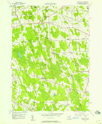
1956 Map of New Haven
USGS Topo · Published 1958About this map
New Haven serves as the central hub of this mid-century landscape in Oswego County, where the New York Central railroad cuts through the northern townships. The area is defined by its small, intersection-based hamlets like Butterfly Corners and Austins Corners, reflecting a settled agricultural character. Significant social and community markers are evident, including the Demster Grove Camp Ground and several rural schools such as Sch No 10.
Find a feature on this map
68 named features on this map. Tap any name to fly to it.
Don’t see what you’re looking for? This feature index may not catch every label — zoom into the map to look around manually.
Map Details
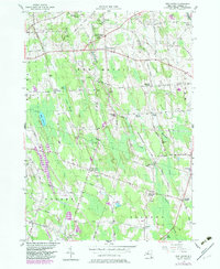
Editions of this 1956 New Haven Map
2 editions found
Other maps of this area

1895 · Pulaski
USGS Topo · 1:62,500

1900 · Fulton
USGS Topo · 1:62,500

1905 · Mexico
USGS Topo · 1:62,500

1943 · Pulaski
USGS Topo · 1:31,680

1943 · Oswego East
USGS Topo · 1:31,680

1943 · New Haven
USGS Topo · 1:31,680

1943 · Texas
USGS Topo · 1:31,680

1943 · Mexico
USGS Topo · 1:31,680

1943 · Pennellville
USGS Topo · 1:31,680

1943 · West Of Texas
USGS Topo · 1:31,680