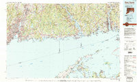
1983 Map of New Haven
USGS Topo · Published 1985About this map
New Haven anchors the western edge of this 1983 coastal study, where the Quinnipiac River meets Long Island Sound near West Rock Ridge State Park. The map documents a heavily developed shoreline defined by major transport corridors including Amtrak and Conrail lines, connecting established hubs like Milford, Branford, and Guilford. Inland, the landscape rises toward Totoket Mountain and the prominent ridges of Sleeping Giant State Park.
Find a feature on this map
59 named features on this map. Tap any name to fly to it.
Don’t see what you’re looking for? This feature index may not catch every label — zoom into the map to look around manually.
Map Details
Editions of this 1983 New Haven Map
2 editions found
Other maps of this area

1889 · Stonington
USGS Topo · 1:62,500

1889 · Derby
USGS Topo · 1:62,500

1889 · Moosup
USGS Topo · 1:62,500

1891 · Bridgeport
USGS Topo · 1:62,500

1891 · Derby
USGS Topo · 1:62,500

1892 · New Haven
USGS Topo · 1:62,500

1892 · New London
USGS Topo · 1:62,500

1892 · Norwich
USGS Topo · 1:62,500

1892 · Meriden
USGS Topo · 1:62,500

1892 · Gilead
USGS Topo · 1:62,500