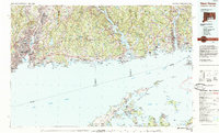
1983 Map of New Haven
USGS Topo · Published 1985About this map
Yale University and the urban density of New Haven anchor the western edge of this 1983 coastal survey, which tracks the Long Island Sound shoreline eastward through New London and Groton. The landscape is defined by the significant river outlets of the Quinnipiac River, Connecticut River, and Thames River, where institutional and maritime history converge at sites like the U.S. Coast Guard Academy. Inland, the terrain rises toward Totoket Mountain and the expansive waters of Lake Gaillard.
Find a feature on this map
206 named features on this map. Tap any name to fly to it.
Don’t see what you’re looking for? This feature index may not catch every label — zoom into the map to look around manually.
Map Details
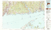
Editions of this 1983 New Haven Map
2 editions found
Other maps of this area

1889 · Stonington
USGS Topo · 1:62,500

1889 · Derby
USGS Topo · 1:62,500

1889 · Moosup
USGS Topo · 1:62,500

1891 · Bridgeport
USGS Topo · 1:62,500

1891 · Derby
USGS Topo · 1:62,500

1892 · New Haven
USGS Topo · 1:62,500

1892 · New London
USGS Topo · 1:62,500

1892 · Norwich
USGS Topo · 1:62,500

1892 · Meriden
USGS Topo · 1:62,500

1892 · Gilead
USGS Topo · 1:62,500