
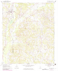
1970 Map of New Hebron
USGS Topo · Published 1972About this map
New Hebron sits along the Illinois Central railroad line, serving as a primary hub for this rural stretch of the Lawrence and Jefferson Davis County border. The 1970 landscape is deeply tied to its natural resources, with an active Oil and Gas Field and numerous Gas Wells and Drill Holes scattered across the wooded terrain. Education and faith are central to the community's layout, anchored by the Oakley Jr High School and a dense network of country churches and cemeteries, including North Silver Creek Ch and St Marys Cem. The area’s varied topography is defined by features like Fiddlers Hollow and the divided headwaters of the West Prong and East Prong Gwinville Branch, which drain into the larger Silver Creek valley.
Find a feature on this map
43 named features on this map. Tap any name to fly to it.
Don’t see what you’re looking for? This feature index may not catch every label — zoom into the map to look around manually.
Map Details
Editions of this 1970 New Hebron Map
2 editions found
Other maps of this area

1953 · Hattiesburg
USGS Topo · 1:250,000

1953 · Natchez
USGS Topo · 1:250,000

1956 · Natchez
USGS Topo · 1:250,000

1958 · Hattiesburg
USGS Topo · 1:250,000

1959 · Natchez
USGS Topo · 1:250,000

1970 · Prentiss West
USGS Topo · 1:24,000

1970 · Monticello
USGS Topo · 1:24,000

1970 · Prentiss East
USGS Topo · 1:24,000

1970 · Mount Carmel
USGS Topo · 1:24,000

1971 · Schley
USGS Topo · 1:24,000