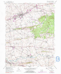
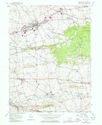
1956 Map of New Holland
USGS Topo · Published 1991About this map
New Holland serves as a primary hub for this fertile agricultural landscape in Lancaster County, as shown in this mid-century survey with later updates. The township boundaries of Earl, Leacock, and Salisbury divide a region defined by small crossroad settlements and a dense network of local landmarks. The Conrail line runs east-west, connecting the industrial operations and New Holland Airport to outlying villages like Blue Ball and East Earl.
Find a feature on this map
74 named features on this map. Tap any name to fly to it.
Don’t see what you’re looking for? This feature index may not catch every label — zoom into the map to look around manually.
Map Details
Editions of this 1956 New Holland Map
5 editions found
Other maps of this area

1904 · Coatesville
USGS Topo · 1:62,500

1905 · Honey Brook
USGS Topo · 1:62,500

1906 · Coatesville
USGS Topo · 1:62,500

1906 · New Holland
USGS Topo · 1:62,500

1907 · Honeybrook
USGS Topo · 1:62,500

1908 · New Holland
USGS Topo · 1:62,500

1912 · Quarryville
USGS Topo · 1:62,500

1918 · Coatesville
USGS Topo · 1:62,500

1941 · Honeybrook
USGS Topo · 1:62,500

1941 · New Holland
USGS Topo · 1:62,500
Featured Places
- East Earl Township, PA
- New Holland, PA
- Paradise Township, PA
- Blue Ball, East Earl Township
- Leacock Township, PA