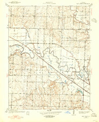
1937 Map of New Home
USGS Topo · Published 1955About this map
The Osage River meanders through the heart of this Bates County landscape, defining the local geography with distinctive turns like Double S Bend and Big Shoe Bend. Agriculture and industry are intertwined across the townships of Charlotte, MT Pleasant, and New Home, as seen in the presence of the Black Diamond Mine and a complex network of drainage features including the County Drainage Ditch and Lateral Ditch. These waterways were critical for managing the river's floodplain to support the area's rural economy.
Find a feature on this map
38 named features on this map. Tap any name to fly to it.
Don’t see what you’re looking for? This feature index may not catch every label — zoom into the map to look around manually.
Map Details
Editions of this 1937 New Home Map
3 editions found
Other maps of this area

1887 · Butler
USGS Topo · 1:125,000

1887 · Mound City
USGS Topo · 1:125,000

1893 · Mound City
USGS Topo · 1:125,000

1894 · Butler
USGS Topo · 1:125,000

1936 · Rich Hill
USGS Topo · 1:24,000

1937 · New Home
USGS Topo · 1:24,000

1938 · Worland
USGS Topo · 1:24,000

1940 · Worland
USGS Topo · 1:24,000

1940 · Hume
USGS Topo · 1:24,000

1942 · Hume
USGS Topo · 1:24,000