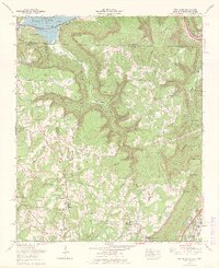
1970 Map of New Home
USGS Topo · Published 1972About this map
Nickajack Lake and the Tennessee River dominate the northern landscape of this tri-state border region, where Tennessee, Alabama, and Georgia meet. The terrain is defined by the steep escarpments of Lendermann Ridge and the deep incision of Nickajack Cove. Historically significant for its industrial and natural features, the area shows evidence of extensive strip mines along the ridge tops, contrasting with the river-bottom settlements of Louisville and Whiteside.
Find a feature on this map
72 named features on this map. Tap any name to fly to it.
Don’t see what you’re looking for? This feature index may not catch every label — zoom into the map to look around manually.
Map Details
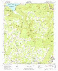
Editions of this 1970 New Home Map
2 editions found
Other maps of this area

1886 · Ringgold
USGS Topo · 1:125,000

1886 · Stevenson
USGS Topo · 1:125,000

1888 · Chattanooga
USGS Topo · 1:125,000

1892 · Ringgold
USGS Topo · 1:125,000

1892 · Stevenson
USGS Topo · 1:125,000

1893 · Chattanooga
USGS Topo · 1:125,000

1895 · Stevenson
USGS Topo · 1:125,000

1895 · Sewanee
USGS Topo · 1:125,000

1935 · Durham
USGS Topo · 1:24,000

1936 · Trenton
USGS Topo · 1:24,000