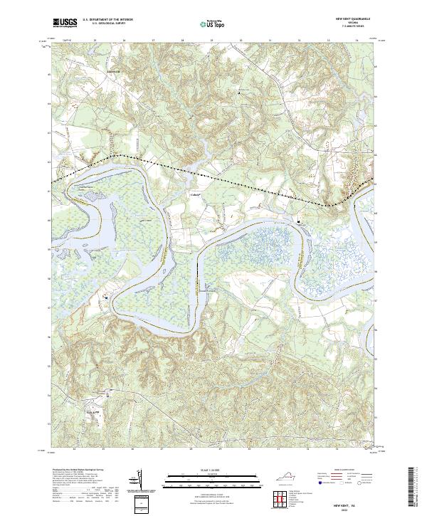
2022 Map of New Kent
USGS Topo · Published 2022About this map
The Pamunkey River winds through the Tidewater landscape, defining the jagged boundary between New Kent and King William counties. This survey highlights the intricate network of tidal waterways and wetlands, including Courthouse Marsh, Lilly Point Marsh, and the broad expanse of Sweet Hall Marsh. These marshes are interspersed with significant riverine features like Chandlers Island and Chamberlayne Point, illustrating the shifting alluvial geography of the Virginia coastal plain.
Find a feature on this map
90 named features on this map. Tap any name to fly to it.
Don’t see what you’re looking for? This feature index may not catch every label — zoom into the map to look around manually.
Map Details
Editions of this 2022 New Kent Map
This is the sole edition of this map. No revisions or reprints were ever made.
Other maps of this area

1917 · Toano
USGS Topo · 1:62,500

1918 · Charles City
USGS Topo · 1:62,500

1918 · Toano
USGS Topo · 1:62,500

1919 · New Kent
USGS Topo · 1:62,500

1920 · King William
USGS Topo · 1:62,500

1943 · Richmond
USGS Topo · 1:250,000
1949 · Truhart
USGS Topo · 1:24,000
1949 · King William
USGS Topo · 1:24,000
1949 · King And Queen
USGS Topo · 1:24,000

1949 · Tunstall
USGS Topo · 1:24,000