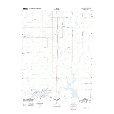
2012 Map of New Lancaster
USGS Topo · Published 2012About this map
New Lancaster and the surrounding rural landscape of Miami County are defined by a network of sectional roads and meandering creek beds in this 2012 study. The map documents the quiet intersection of Drexel Corner and the small community of Jingo, providing a clear view of the region's burial grounds including New Lancaster Cem, Rockville Cem, and Jingo Cem. The geography is shaped by the drainage patterns of Middle Cr and Elm Cr, which flow toward the southern portion of the sheet near La Cygnes Lake.
Find a feature on this map
55 named features on this map. Tap any name to fly to it.
Don’t see what you’re looking for? This feature index may not catch every label — zoom into the map to look around manually.
Map Details
Editions of this 2012 New Lancaster Map
This is the sole edition of this map. No revisions or reprints were ever made.
Other maps of this area

1887 · Olathe
USGS Topo · 1:125,000

1887 · Mound City
USGS Topo · 1:125,000

1893 · Mound City
USGS Topo · 1:125,000

1893 · Olathe
USGS Topo · 1:125,000

1947 · Lawrence
USGS Topo · 1:250,000

1950 · Lawrence
USGS Topo · 1:250,000

1953 · Freeman
USGS Topo · 1:24,000

1956 · Paola East
USGS Topo · 1:24,000

1956 · Lawrence
USGS Topo · 1:250,000
1957 · Louisburg
USGS Topo · 1:24,000