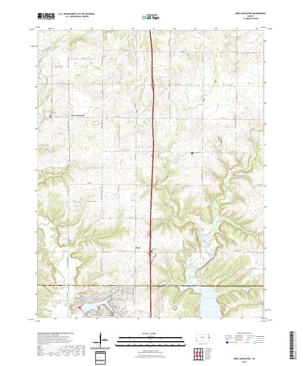
2022 Map of New Lancaster
USGS Topo · Published 2022About this map
New Lancaster serves as a focal point for this portion of the Kansas plains, situated along the county line between Miami Co and Linn Co. The landscape is defined by the headwaters and meandering courses of Walnut Cr, Middle Cr, and Elm Creek. To the south, the development around Linn Valley introduces a denser network of residential streets such as Oak Crest Dr and Fawn Valley Dr, contrasting with the surrounding traditional agricultural grid. This modern survey captures the region just north of La Cygne Lake, where rural traditions are preserved in sites like the New Lancaster Cem, Rockville Cem, and Jingo Cem. The geography is characterized by the gradual transition from open prairie to the wooded drainages of North Sugar Creek.
Find a feature on this map
63 named features on this map. Tap any name to fly to it.
Don’t see what you’re looking for? This feature index may not catch every label — zoom into the map to look around manually.
Map Details
Editions of this 2022 New Lancaster Map
This is the sole edition of this map. No revisions or reprints were ever made.
Other maps of this area

1887 · Olathe
USGS Topo · 1:125,000

1887 · Mound City
USGS Topo · 1:125,000

1893 · Mound City
USGS Topo · 1:125,000

1893 · Olathe
USGS Topo · 1:125,000

1947 · Lawrence
USGS Topo · 1:250,000

1950 · Lawrence
USGS Topo · 1:250,000

1953 · Freeman
USGS Topo · 1:24,000

1956 · Paola East
USGS Topo · 1:24,000

1956 · Lawrence
USGS Topo · 1:250,000
1957 · Louisburg
USGS Topo · 1:24,000