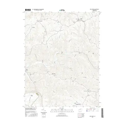
2016 Map of New Liberty
USGS Topo · Published 2016About this map
The Kentucky River flows along the western boundary of this northern Kentucky landscape, where the fertile Marshall Bottom meets the rising terrain of Pink Ridge. The area is defined by a dense network of family and community landmarks, particularly evident in the clusters of burial grounds and houses of worship. In the town of New Liberty, the presence of the New Liberty IOOF Cem and the New Liberty Baptist Church reflects a long-established settlement pattern, while smaller hamlets like Squiresville and Wheatley serve as local hubs for the surrounding farmsteads. The terrain is deeply dissected by watercourses such as Big Twin Creek and Mill Cr, which have historically dictated the placement of winding roads like Quissenberry Pike. Genealogists will find a wealth of specific family-named sites, including the Benjamin Hancock Cem and Lusby/Kemper Cem, which preserve the names of early inhabitants in this rural corner of Owen and Henry counties.
Find a feature on this map
65 named features on this map. Tap any name to fly to it.
Don’t see what you’re looking for? This feature index may not catch every label — zoom into the map to look around manually.
Map Details
Editions of this 2016 New Liberty Map
This is the sole edition of this map. No revisions or reprints were ever made.
Other maps of this area

1906 · Lockport
USGS Topo · 1:48,000

1908 · Lockport
USGS Topo · 1:62,500

1928 · New Castle
USGS Topo · 1:48,000

1932 · New Castle
USGS Topo · 1:62,500

1943 · Vevay South
USGS Topo · 1:24,000

1950 · New Liberty
USGS Topo · 1:24,000

1950 · Glencoe
USGS Topo · 1:24,000

1950 · Owenton
USGS Topo · 1:24,000

1951 · Sanders
USGS Topo · 1:24,000

1952 · Vevay South
USGS Topo · 1:24,000