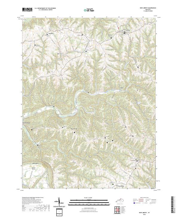
2022 Map of New Liberty
USGS Topo · Published 2022About this map
The Kentucky River carves the southwestern corner of this landscape, creating the fertile flat of Marshall Bottom before the terrain rises into the densely folded ridges of Owen County. This area is defined by a deep network of family and fraternal history, evidenced by the numerous small burial grounds and community centers that dot the rural crossroads. Settlements like New Liberty and Wheatley serve as anchors in the north, while smaller locales such as Squiresville and Pleasant Home are tucked between the winding branches of Big Twin Creek and Mill Cr.
Find a feature on this map
76 named features on this map. Tap any name to fly to it.
Don’t see what you’re looking for? This feature index may not catch every label — zoom into the map to look around manually.
Map Details
Editions of this 2022 New Liberty Map
This is the sole edition of this map. No revisions or reprints were ever made.
Other maps of this area

1906 · Lockport
USGS Topo · 1:48,000

1908 · Lockport
USGS Topo · 1:62,500

1928 · New Castle
USGS Topo · 1:48,000

1932 · New Castle
USGS Topo · 1:62,500

1943 · Vevay South
USGS Topo · 1:24,000

1950 · New Liberty
USGS Topo · 1:24,000

1950 · Glencoe
USGS Topo · 1:24,000

1950 · Owenton
USGS Topo · 1:24,000

1951 · Sanders
USGS Topo · 1:24,000

1952 · Vevay South
USGS Topo · 1:24,000