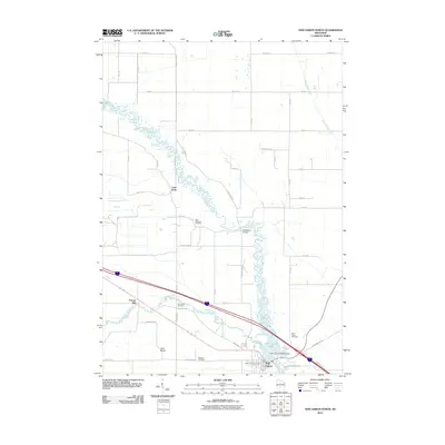
2010 Map of New Lisbon North
USGS Topo · Published 2010About this map
The Lemonweir River meanders dramatically across this central Wisconsin landscape, shaping the development of New Lisbon at the start of the 21st century. The river's path is punctuated by the New Lisbon 2WP254 Dam, which creates New Lisbon Lake and historical crossing points like Buckleys Bridge. For those researching local heritage, the map identifies several rural burying grounds including Saint Stephens Cemetery, Lone Rock Cemetery, and Brewster Cemetery. The settlement pattern follows a mix of river-aligned features and a strict grid of rural roads such as Silvernagel Rd and Fish Rd. Smaller named locations like Orange Mill, Twin Bluffs, and Lone Rock provide specific points of interest for genealogists and local historians tracking the evolution of Juneau County's rural townships.
Find a feature on this map
36 named features on this map. Tap any name to fly to it.
Don’t see what you’re looking for? This feature index may not catch every label — zoom into the map to look around manually.
Map Details
Editions of this 2010 New Lisbon North Map
This is the sole edition of this map. No revisions or reprints were ever made.
Other maps of this area

1919 · Kendall
USGS Topo · 1:62,500

1921 · Mauston
USGS Topo · 1:62,500

1921 · Kendall
USGS Topo · 1:62,500

1953 · Eau Claire
USGS Topo · 1:250,000

1958 · Eau Claire
USGS Topo · 1:250,000

1958 · Necedah
USGS Topo · 1:48,000

1958 · Wyeville
USGS Topo · 1:48,000

1958 · La Crosse
USGS Topo · 1:250,000

1961 · La Crosse
USGS Topo · 1:250,000

1962 · Kendall
USGS Topo · 1:62,500