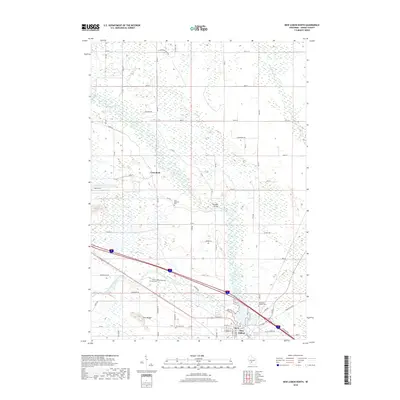
2018 Map of New Lisbon North
USGS Topo · Published 2018About this map
The Lemonweir River and its tributaries define the low-lying terrain of Juneau County, Wisconsin, creating a complex network of wetlands and wandering watercourses. The northern outskirts of New Lisbon are situated at the confluence of these waters, where the Little Lemonweir River and Little Yellow River meet the main stem. This area is characterized by a mix of agricultural plots and dense marshland, punctuated by geological outliers like Lone Rock and Twin Bluffs. The map documents several local burial grounds essential for genealogical research, including Saint Paul's Catholic Cem and Orange Cem. Transport and infrastructure are represented by the intersection of major roads and historical crossings such as Buckleys Bridge, while the proximity of Volk Field to the west indicates the significant military footprint in the region.
Find a feature on this map
52 named features on this map. Tap any name to fly to it.
Don’t see what you’re looking for? This feature index may not catch every label — zoom into the map to look around manually.
Map Details
Editions of this 2018 New Lisbon North Map
This is the sole edition of this map. No revisions or reprints were ever made.
Other maps of this area

1919 · Kendall
USGS Topo · 1:62,500

1921 · Mauston
USGS Topo · 1:62,500

1921 · Kendall
USGS Topo · 1:62,500

1953 · Eau Claire
USGS Topo · 1:250,000

1958 · Eau Claire
USGS Topo · 1:250,000

1958 · Necedah
USGS Topo · 1:48,000

1958 · Wyeville
USGS Topo · 1:48,000

1958 · La Crosse
USGS Topo · 1:250,000

1961 · La Crosse
USGS Topo · 1:250,000

1962 · Kendall
USGS Topo · 1:62,500