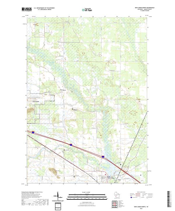
2022 Map of New Lisbon North
USGS Topo · Published 2022About this map
The Lemonweir River and its tributaries define the landscape of this Juneau County survey, where the Little Lemonweir River flows toward the settlement of New Lisbon in the south. The terrain is marked by distinctive formations like Twin Bluffs, which rise above the surrounding wetlands and river plains. The map provides a detailed record of the local genealogical landscape, preserving the locations of numerous historic burial grounds including Saint Stephens Evangelical Lutheran Cem, Brewster Cem, and Saint Paul's Catholic Cem.
Find a feature on this map
63 named features on this map. Tap any name to fly to it.
Don’t see what you’re looking for? This feature index may not catch every label — zoom into the map to look around manually.
Map Details
Editions of this 2022 New Lisbon North Map
This is the sole edition of this map. No revisions or reprints were ever made.
Other maps of this area

1919 · Kendall
USGS Topo · 1:62,500

1921 · Mauston
USGS Topo · 1:62,500

1921 · Kendall
USGS Topo · 1:62,500

1953 · Eau Claire
USGS Topo · 1:250,000

1958 · Eau Claire
USGS Topo · 1:250,000

1958 · Necedah
USGS Topo · 1:48,000

1958 · Wyeville
USGS Topo · 1:48,000

1958 · La Crosse
USGS Topo · 1:250,000

1961 · La Crosse
USGS Topo · 1:250,000

1962 · Kendall
USGS Topo · 1:62,500