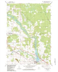
1983 Map of New Lisbon North
USGS Topo · Published 1984About this map
The Lemonweir River and Little Lemonweir River converge just north of New Lisbon, shaping a landscape where water and transport networks define the local character. This 1983 revision shows the prominent footprint of Volk Field (Air National Guard) in the west, while the southeastern corner is dominated by the city of New Lisbon and the adjacent New Lisbon Lake. The Chicago Milwaukee St Paul and Pacific railroad tracks bisect the southern half of the quadrangle, passing through a rural landscape dotted with family-named burial sites such as Brewster Cem, Lone Rock Cem, and St Stephens Cem.
Find a feature on this map
46 named features on this map. Tap any name to fly to it.
Don’t see what you’re looking for? This feature index may not catch every label — zoom into the map to look around manually.
Map Details
Editions of this 1983 New Lisbon North Map
This is the sole edition of this map. No revisions or reprints were ever made.
Other maps of this area

1919 · Kendall
USGS Topo · 1:62,500

1921 · Mauston
USGS Topo · 1:62,500

1921 · Kendall
USGS Topo · 1:62,500

1953 · Eau Claire
USGS Topo · 1:250,000

1958 · Eau Claire
USGS Topo · 1:250,000

1958 · Necedah
USGS Topo · 1:48,000

1958 · Wyeville
USGS Topo · 1:48,000

1958 · La Crosse
USGS Topo · 1:250,000

1961 · La Crosse
USGS Topo · 1:250,000

1962 · Kendall
USGS Topo · 1:62,500