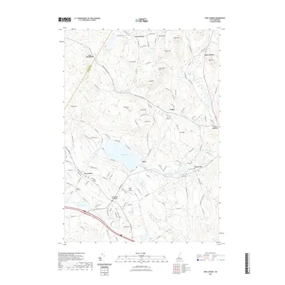
2021 Map of New London
USGS Topo · Published 2021About this map
New London and the campus of Colby-Sawyer College anchor this survey of Merrimack County, where the landscape is defined by its many summits and the waters of Pleasant Lake. The settlement pattern follows the local topography, with villages like Elkins and Wilmot Flat situated along the drainage of Cascade Brook and Chase Pond. A network of historic roads, including the New Hampshire Tpke and Quaker Path Rd, connects these communities across high ground like Bog Mtn and Philbrick Hill.
Find a feature on this map
136 named features on this map. Tap any name to fly to it.
Don’t see what you’re looking for? This feature index may not catch every label — zoom into the map to look around manually.
Map Details
Editions of this 2021 New London Map
This is the sole edition of this map. No revisions or reprints were ever made.
Other maps of this area

1902 · Sunapee
USGS Topo · 1:62,500

1905 · Sunapee
USGS Topo · 1:62,500

1907 · Sunapee
USGS Topo · 1:62,500

1927 · Cardigan
USGS Topo · 1:62,500

1927 · Mascoma
USGS Topo · 1:62,500

1928 · Mount Kearsarge
USGS Topo · 1:62,500

1930 · Cardigan
USGS Topo · 1:62,500

1931 · Mount Kearsarge
USGS Topo · 1:62,500

1932 · Mascoma
USGS Topo · 1:62,500

1949 · Portland
USGS Topo · 1:250,000