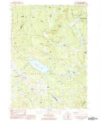
1987 Map of New London
USGS Topo · Published 1987About this map
The hills of Merrimack County are defined by a complex landscape of glacial ponds and prominent peaks in the late 1980s. Pleasant Lake serves as a central geographic anchor, surrounded by the village of Elkins and the nearby campus of Colby Jr College in New London. This region highlights the varied land use of central New Hampshire, where conserved lands like the Gile State Memorial Forest and the Cascade Marsh State Wildlife Management Area sit adjacent to working landscapes including several gravel pits.
Find a feature on this map
60 named features on this map. Tap any name to fly to it.
Don’t see what you’re looking for? This feature index may not catch every label — zoom into the map to look around manually.
Map Details
Editions of this 1987 New London Map
This is the sole edition of this map. No revisions or reprints were ever made.
Other maps of this area

1902 · Sunapee
USGS Topo · 1:62,500

1905 · Sunapee
USGS Topo · 1:62,500

1907 · Sunapee
USGS Topo · 1:62,500

1927 · Cardigan
USGS Topo · 1:62,500

1927 · Mascoma
USGS Topo · 1:62,500

1928 · Mount Kearsarge
USGS Topo · 1:62,500

1930 · Cardigan
USGS Topo · 1:62,500

1931 · Mount Kearsarge
USGS Topo · 1:62,500

1932 · Mascoma
USGS Topo · 1:62,500

1949 · Portland
USGS Topo · 1:250,000