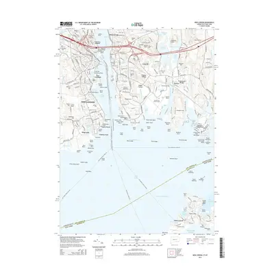
2015 Map of New London
USGS Topo · Published 2015About this map
New London and its surrounding maritime landscape are defined by the deep waters of the Thames River, where the Gold Star Memorial Bridge links the city to Long Hill and Poquonock Bridge. This coastal hub is home to established institutions such as the United States Coast Guard Acad and Mitchell Coll, alongside military and historical landmarks like Fort Trumbull. To the south, the map extends across the Long Island Sound to include Fishers Island, where Elizabeth Field and West Harbor anchor the island's geography.
Find a feature on this map
228 named features on this map. Tap any name to fly to it.
Don’t see what you’re looking for? This feature index may not catch every label — zoom into the map to look around manually.
Map Details
Editions of this 2015 New London Map
This is the sole edition of this map. No revisions or reprints were ever made.
Other maps of this area

1889 · Stonington
USGS Topo · 1:62,500

1892 · New London
USGS Topo · 1:62,500

1893 · Stonington
USGS Topo · 1:62,500

1893 · New London
USGS Topo · 1:62,500

1903 · Gardiners Island
USGS Topo · 1:62,500

1904 · Gardiners Island
USGS Topo · 1:62,500

1904 · Montauk
USGS Topo · 1:62,500

1921 · Gardiners Island
USGS Topo · 1:62,500

1921 · New London
USGS Topo · 1:62,500

1921 · Stonington
USGS Topo · 1:62,500