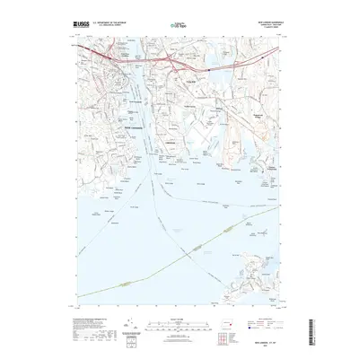
2021 Map of New London
USGS Topo · Published 2021About this map
The Thames River serves as the central artery for this maritime region, separating the historic port of New London from the city of Groton. This contemporary survey highlights a landscape where military history and modern education intersect, from the United States Coast Guard Academy in the north to the strategically positioned Fort Trumbull and Ft Griswold. The map documents a dense network of local landmarks, including the notable Ye Antientist Burial Ground and the sprawling Cedar Grove Cem.
Find a feature on this map
181 named features on this map. Tap any name to fly to it.
Don’t see what you’re looking for? This feature index may not catch every label — zoom into the map to look around manually.
Map Details
Editions of this 2021 New London Map
This is the sole edition of this map. No revisions or reprints were ever made.
Other maps of this area

1889 · Stonington
USGS Topo · 1:62,500

1892 · New London
USGS Topo · 1:62,500

1893 · Stonington
USGS Topo · 1:62,500

1893 · New London
USGS Topo · 1:62,500

1903 · Gardiners Island
USGS Topo · 1:62,500

1904 · Gardiners Island
USGS Topo · 1:62,500

1904 · Montauk
USGS Topo · 1:62,500

1921 · Gardiners Island
USGS Topo · 1:62,500

1921 · New London
USGS Topo · 1:62,500

1921 · Stonington
USGS Topo · 1:62,500