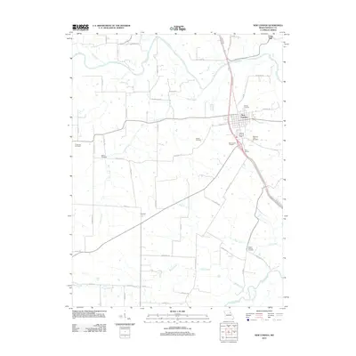
2012 Map of New London
USGS Topo · Published 2012About this map
New London serves as the focal point of this Ralls County landscape, situated where the terrain begins to transition from agricultural uplands toward the winding course of the Salt River. In the early 21st century, the area shows a clear pattern of rural development, with clusters of family and community burial grounds like Barkley Cemetery, Pleasant View Cemetery, and Watson Cemetery preserved among the fields. The drainage network is particularly detailed, tracing the paths of Turkey Creek and Plum Creek as they move toward the river valley. Further south, the small settlement of Owendale sits near the intersection of several county routes, reflecting the enduring rural infrastructure of the region. Distinctive landmarks such as Flint Hill and Ralls Junction provide orientation within a landscape largely defined by its network of named roads, including New London Gravel Rd and Kingsville Rd.
Find a feature on this map
57 named features on this map. Tap any name to fly to it.
Don’t see what you’re looking for? This feature index may not catch every label — zoom into the map to look around manually.
Map Details
Editions of this 2012 New London Map
This is the sole edition of this map. No revisions or reprints were ever made.
Other maps of this area

1890 · Louisiana
USGS Topo · 1:125,000

1890 · Mexico
USGS Topo · 1:125,000

1903 · Palmyra
USGS Topo · 1:125,000

1932 · Hannibal
USGS Topo · 1:62,500

1936 · Hannibal
USGS Topo · 1:48,000

1943 · Vandalia
USGS Topo · 1:62,500

1945 · Hannibal
USGS Topo · 1:62,500

1945 · Perry
USGS Topo · 1:62,500

1945 · Vandalia
USGS Topo · 1:62,500

1948 · Quincy
USGS Topo · 1:250,000