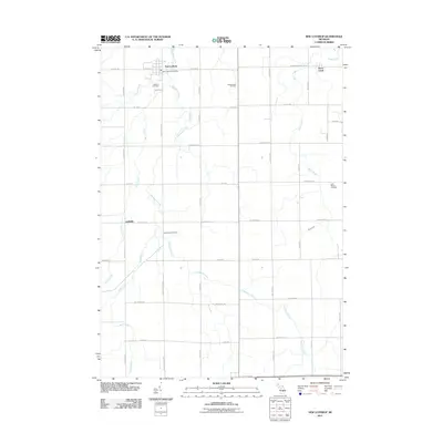
2011 Map of New Lothrop
USGS Topo · Published 2011About this map
New Lothrop serves as the primary hub in this agricultural region of Shiawassee County, anchored by the New Lothrop Post Office and the nearby Hazelton Cemetery. The landscape is defined by a dense grid of country roads that follow the section lines, intersecting at small communities like Juddville and Brent Creek. Natural drainage is provided by a network of waterways including Misteguay Creek, Onion Creek, and Rush Creek, which weave through the predominantly flat terrain. An industrial presence is noted in the northeast quadrant at the Shiawassee Oil Field. For genealogists, the map is particularly useful for locating rural burial sites such as Cummings Cemetery and Saint Roberts Cemetery, which remain preserved amidst the surrounding farmland and orchards.
Find a feature on this map
33 named features on this map. Tap any name to fly to it.
Don’t see what you’re looking for? This feature index may not catch every label — zoom into the map to look around manually.
Map Details
Editions of this 2011 New Lothrop Map
This is the sole edition of this map. No revisions or reprints were ever made.
Other maps of this area

1917 · Chesaning
USGS Topo · 1:62,500

1919 · Burt
USGS Topo · 1:62,500

1921 · Burt
USGS Topo · 1:62,500

1922 · Durand
USGS Topo · 1:62,500

1926 · Corunna
USGS Topo · 1:62,500

1929 · Corunna
USGS Topo · 1:62,500

1943 · Burt
USGS Topo · 1:62,500

1943 · Chesaning
USGS Topo · 1:62,500

1943 · Durand
USGS Topo · 1:62,500

1944 · Corunna
USGS Topo · 1:62,500