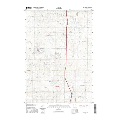
2016 Map of New Market
USGS Topo · Published 2016About this map
The consolidated community of Elko and New Market serves as the focal point of this Scott County landscape, reflecting the suburban expansion into formerly rural Minnesota farmland. Residential growth is evident in the street grids surrounding these settlements, while legacy landmarks like the West Christiania Cem and the small hamlet of Eidswold provide historical anchors for local genealogists. The terrain is defined by a glacial marshland character, featuring the Pettit Wildlife Pond and Sweetbrier Lake in the north, alongside the drainage of the Credit River and the Vermillion River.
Find a feature on this map
49 named features on this map. Tap any name to fly to it.
Don’t see what you’re looking for? This feature index may not catch every label — zoom into the map to look around manually.
Map Details
Editions of this 2016 New Market Map
This is the sole edition of this map. No revisions or reprints were ever made.
Other maps of this area

1953 · Saint Paul
USGS Topo · 1:250,000

1957 · Farmington
USGS Topo · 1:62,500

1957 · Prior Lake
USGS Topo · 1:62,500

1959 · Saint Paul
USGS Topo · 1:250,000

1960 · Northfield
USGS Topo · 1:24,000

1960 · Lonsdale
USGS Topo · 1:24,000

1960 · Little Chicago
USGS Topo · 1:24,000
1974 · Prior Lake
USGS Topo · 1:24,000
1974 · New Market
USGS Topo · 1:24,000
1974 · Veseli
USGS Topo · 1:24,000