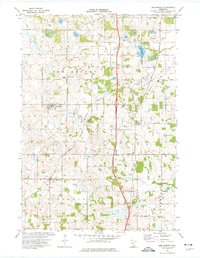
1974 Map of New Market
USGS Topo · Published 1976About this map
New Market and Elko anchor this mid-1970s landscape where rural townships converge across Scott, Rice, and Dakota counties. The region is defined by a dense network of country roads, including 280th Street and 305th Street, which connect small communities like Webster and Hazelwood. Local spiritual and community life is anchored by the West Christiania Cem and Solor Ch, while more modern developments such as the Minnesota National Speedway and Sky Harbor Airpark indicate the area's mid-century shift toward recreation and transit.
Find a feature on this map
34 named features on this map. Tap any name to fly to it.
Don’t see what you’re looking for? This feature index may not catch every label — zoom into the map to look around manually.
Map Details
Editions of this 1974 New Market Map
This is the sole edition of this map. No revisions or reprints were ever made.
Other maps of this area

1953 · Saint Paul
USGS Topo · 1:250,000

1957 · Farmington
USGS Topo · 1:62,500

1957 · Prior Lake
USGS Topo · 1:62,500

1959 · Saint Paul
USGS Topo · 1:250,000

1960 · Northfield
USGS Topo · 1:24,000

1960 · Lonsdale
USGS Topo · 1:24,000

1960 · Little Chicago
USGS Topo · 1:24,000
1974 · Prior Lake
USGS Topo · 1:24,000
1974 · Veseli
USGS Topo · 1:24,000
1974 · Castle Rock
USGS Topo · 1:24,000
Featured Places
- Elko New Market, MN
- Webster, MN
- New Market, Elko New Market
- Elko, Elko New Market
- Greenvale Township, MN