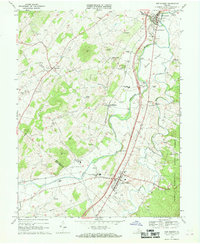
1967 Map of New Market
USGS Topo · Published 1969About this map
The North Fork Shenandoah River carves a deep path through this section of the Valley, defining the local landscape between Timber Ridge and the George Washington National Forest. The map documents the area during a period of infrastructure growth, showing the construction of Interchange 67 and Interchange 68 along the new highway corridor bypassing the town of New Market. Despite these modern additions, the region remains rooted in its past, with the New Market Battlefield preserved near the river and the Southern railroad serving established communities like Quicksburg and Mt Jackson.
Find a feature on this map
63 named features on this map. Tap any name to fly to it.
Don’t see what you’re looking for? This feature index may not catch every label — zoom into the map to look around manually.
Map Details
Editions of this 1967 New Market Map
Other maps of this area

1892 · Woodstock
USGS Topo · 1:125,000

1921 · Orkney Springs
USGS Topo · 1:48,000

1923 · Orkney Springs
USGS Topo · 1:62,500

1923 · Edinburg
USGS Topo · 1:62,500

1940 · Orkney Springs
USGS Topo · 1:48,000

1942 · Mt Jackson
USGS Topo · 1:62,500

1943 · Orkney Springs
USGS Topo · 1:62,500

1944 · Orkney Springs
USGS Topo · 1:62,500

1946 · Mt Jackson
USGS Topo · 1:62,500

1947 · Mt Jackson
USGS Topo · 1:62,500