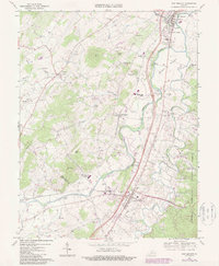
1967 Map of New Market
USGS Topo · Published 1987About this map
The North Fork Shenandoah River winds through the heart of the Shenandoah Valley, carving a path between the steep slopes of Timber Ridge and the broad floodplains of Meems Bottom. This landscape is defined by its deep agricultural and historical roots, where the New Market Battlefield sits near the crossing of the Southern railroad and the river. The presence of the Covered Bridge and numerous country churches like Flat Rock Ch and St Marys Ch reflects a well-established rural community centered around the towns of New Market and Mt Jackson. Local industry and education are represented by the Plains Mill, several quarries, and institutions such as the Triplett Institute and Shenandoah Valley Academy. The map reveals the early development of the interstate system, with Interchange 69 and others beginning to alter the traditional valley travel routes.
Find a feature on this map
58 named features on this map. Tap any name to fly to it.
Don’t see what you’re looking for? This feature index may not catch every label — zoom into the map to look around manually.
Map Details
Editions of this 1967 New Market Map
Other maps of this area

1892 · Woodstock
USGS Topo · 1:125,000

1921 · Orkney Springs
USGS Topo · 1:48,000

1923 · Orkney Springs
USGS Topo · 1:62,500

1923 · Edinburg
USGS Topo · 1:62,500

1940 · Orkney Springs
USGS Topo · 1:48,000

1942 · Mt Jackson
USGS Topo · 1:62,500

1943 · Orkney Springs
USGS Topo · 1:62,500

1944 · Orkney Springs
USGS Topo · 1:62,500

1946 · Mt Jackson
USGS Topo · 1:62,500

1947 · Mt Jackson
USGS Topo · 1:62,500