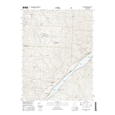
2016 Map of New Matamoras
USGS Topo · Published 2016About this map
The Ohio River dominates the landscape at Long Reach, where a series of river islands including Grandview Island, Mill Creek Island, Wells Island, and Crab Island follow the waterway's path between Ohio and West Virginia. This 2016 survey documents the river-centered geography of Matamoras and Grandview, highlighting the concentration of development along the banks. Further inland, the ridge-and-valley terrain of the Wayne National Forest is defined by sharp topographic relief and numerous family and denominational burial grounds, such as the German Lutheran Cem, Jericho Methodist Cem, and the Brownsville United Presbyterian Cem. These sites, along with settlements like Jericho and Brownsville, reveal the historical distribution of rural communities across the ridges of Washington Co and Monroe Co before the modern era.
Find a feature on this map
121 named features on this map. Tap any name to fly to it.
Don’t see what you’re looking for? This feature index may not catch every label — zoom into the map to look around manually.
Map Details
Editions of this 2016 New Matamoras Map
This is the sole edition of this map. No revisions or reprints were ever made.
Other maps of this area

1905 · West Union
USGS Topo · 1:62,500

1905 · New Matamoras
USGS Topo · 1:62,500

1906 · Saint Marys
USGS Topo · 1:62,500

1906 · New Martinsville
USGS Topo · 1:62,500

1924 · St Marys
USGS Topo · 1:62,500

1924 · New Martinsville
USGS Topo · 1:62,500

1924 · New Matamoras
USGS Topo · 1:62,500

1924 · West Union
USGS Topo · 1:62,500

1926 · New Martinsville
USGS Topo · 1:62,500

1926 · New Matamoras
USGS Topo · 1:62,500