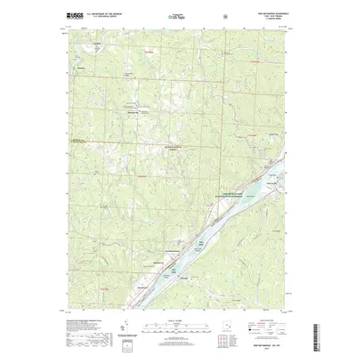
2019 Map of New Matamoras
USGS Topo · Published 2019About this map
The Ohio River serves as the defining border between Ohio and West Virginia, shaping the landscape and settlement patterns of this riverine corridor. Along the Ohio bank, the village of New Matamoras and the community of Grandview anchor a region where the waterway's influence is clear, from Mill Creek Island to Wells Island. The interior is characterized by a dense network of creek-fed hollows and high ridges like Greenbrier Ridge and Ludolph Ridge, much of which is protected within the Wayne National Forest.
Find a feature on this map
84 named features on this map. Tap any name to fly to it.
Don’t see what you’re looking for? This feature index may not catch every label — zoom into the map to look around manually.
Map Details
Editions of this 2019 New Matamoras Map
This is the sole edition of this map. No revisions or reprints were ever made.
Other maps of this area

1905 · West Union
USGS Topo · 1:62,500

1905 · New Matamoras
USGS Topo · 1:62,500

1906 · Saint Marys
USGS Topo · 1:62,500

1906 · New Martinsville
USGS Topo · 1:62,500

1924 · St Marys
USGS Topo · 1:62,500

1924 · New Martinsville
USGS Topo · 1:62,500

1924 · New Matamoras
USGS Topo · 1:62,500

1924 · West Union
USGS Topo · 1:62,500

1926 · New Martinsville
USGS Topo · 1:62,500

1926 · New Matamoras
USGS Topo · 1:62,500