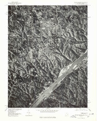
1975 Map of New Matamoras
USGS Topo · Published 1979About this map
Ohio River bank settlements and ridge-top farming communities define the landscape of this 1975 orthophotoquad. This aerial perspective, produced in cooperation with the Soil Conservation Service, captures the intricate topography of Monroe County, Ohio, and the neighboring West Virginia shore. The river serves as the primary corridor for the region, with New Matamoras and Grandview hugging the narrow floodplains below steep, forested bluffs. Across the water, Sistersville sits on a wide bend, while the interior hills of Ohio reveal the isolated settlement of Brownsville. Unlike traditional topographic maps, this imagery provides a direct view of land use, showing the patterns of clearing on the high ridges and the dense canopy of the ravines that drain toward the river.
Find a feature on this map
5 named features on this map. Tap any name to fly to it.
Don’t see what you’re looking for? This feature index may not catch every label — zoom into the map to look around manually.
Map Details
Editions of this 1975 New Matamoras Map
This is the sole edition of this map. No revisions or reprints were ever made.
Other maps of this area

1905 · West Union
USGS Topo · 1:62,500

1905 · New Matamoras
USGS Topo · 1:62,500

1906 · Saint Marys
USGS Topo · 1:62,500

1906 · New Martinsville
USGS Topo · 1:62,500

1924 · St Marys
USGS Topo · 1:62,500

1924 · New Martinsville
USGS Topo · 1:62,500

1924 · New Matamoras
USGS Topo · 1:62,500

1924 · West Union
USGS Topo · 1:62,500

1926 · New Martinsville
USGS Topo · 1:62,500

1926 · New Matamoras
USGS Topo · 1:62,500