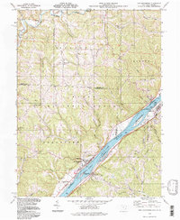
1994 Map of New Matamoras
USGS Topo · Published 1998About this map
New Matamoras and Sistersville anchor this reach of the Ohio River during the late twentieth century, showing a landscape defined by industrial activity and river navigation. The map captures the river's character before major modern shifts, featuring several large islands such as Grandview Island, Wells Island, and Crab Island, the latter of which is part of the Ohio River Islands National Wildlife Refuge. In the hills of Monroe and Washington Counties, the Wayne National Forest surrounds small settlements like Brownsville and Salem Hall. For genealogists and local historians, the sheet preserves the locations of rural landmarks like St Pauls Ch, Zion Ch, and the New Matamoras Cem. The presence of a Sand and Gravel Pit and various Gas Wells suggests the ongoing reliance on natural resource extraction in the region.
Find a feature on this map
61 named features on this map. Tap any name to fly to it.
Don’t see what you’re looking for? This feature index may not catch every label — zoom into the map to look around manually.
Map Details
Editions of this 1994 New Matamoras Map
This is the sole edition of this map. No revisions or reprints were ever made.
Other maps of this area

1905 · West Union
USGS Topo · 1:62,500

1905 · New Matamoras
USGS Topo · 1:62,500

1906 · Saint Marys
USGS Topo · 1:62,500

1906 · New Martinsville
USGS Topo · 1:62,500

1924 · St Marys
USGS Topo · 1:62,500

1924 · New Martinsville
USGS Topo · 1:62,500

1924 · New Matamoras
USGS Topo · 1:62,500

1924 · West Union
USGS Topo · 1:62,500

1926 · New Martinsville
USGS Topo · 1:62,500

1926 · New Matamoras
USGS Topo · 1:62,500