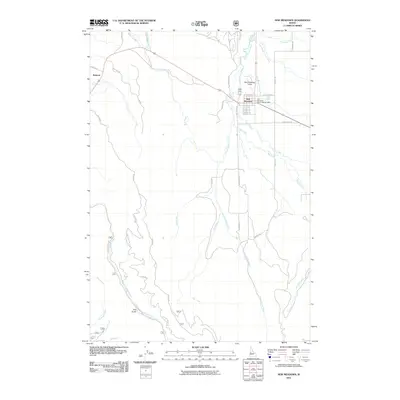
2011 Map of New Meadows
USGS Topo · Published 2011About this map
New Meadows serves as the central hub of this Adams County landscape, situated near the confluence of the Little Salmon River and several mountain-fed creeks. The town's significance as a regional administrative and transportation point is evident by the location of the New Meadows District Ranger Office and the New Meadows Airport. To the west, the smaller settlement of Rubicon sits along the road network leading into the timber-rich highlands.
Find a feature on this map
37 named features on this map. Tap any name to fly to it.
Don’t see what you’re looking for? This feature index may not catch every label — zoom into the map to look around manually.
Map Details
Editions of this 2011 New Meadows Map
This is the sole edition of this map. No revisions or reprints were ever made.
Other maps of this area

1911 · Meadows
USGS Topo · 1:125,000

1938 · Riggins
USGS Topo · 1:96,000

1945 · Riggins
USGS Topo · 1:125,000

1954 · New Meadows
USGS Topo · 1:62,500

1955 · Baker
USGS Topo · 1:250,000

1955 · Grangeville
USGS Topo · 1:250,000

1959 · Baker
USGS Topo · 1:250,000

1959 · Grangeville
USGS Topo · 1:250,000

1963 · Bally Mountain
USGS Topo · 1:24,000
1963 · Railroad Saddle
USGS Topo · 1:24,000