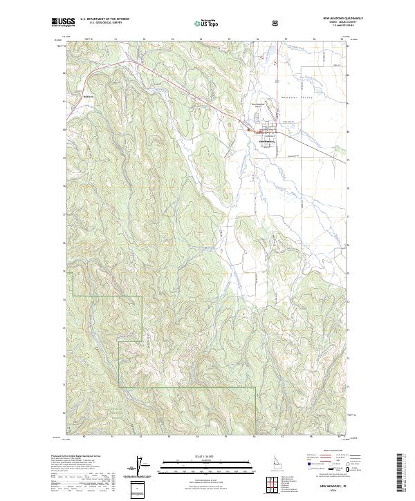
2024 Map of New Meadows
USGS Topo · Published 2024About this map
Meadows Valley serves as a transition between the northern drainage of the Little Salmon River and the high-altitude forested slopes of the Payette National Forest. This contemporary survey shows the hub of New Meadows at the junction of local transit routes, adjacent to the New Meadows Airport and the older corridor of Old Hwy 95. The settlement of Rubicon sits to the west, nestled against the rising timberline where watercourses like Mud Creek and Little Mud Creek emerge from the forest.
Find a feature on this map
66 named features on this map. Tap any name to fly to it.
Don’t see what you’re looking for? This feature index may not catch every label — zoom into the map to look around manually.
Map Details
Editions of this 2024 New Meadows Map
This is the sole edition of this map. No revisions or reprints were ever made.
Other maps of this area

1911 · Meadows
USGS Topo · 1:125,000

1938 · Riggins
USGS Topo · 1:96,000

1945 · Riggins
USGS Topo · 1:125,000

1954 · New Meadows
USGS Topo · 1:62,500

1955 · Baker
USGS Topo · 1:250,000

1955 · Grangeville
USGS Topo · 1:250,000

1959 · Baker
USGS Topo · 1:250,000

1959 · Grangeville
USGS Topo · 1:250,000

1963 · Bally Mountain
USGS Topo · 1:24,000
1963 · Railroad Saddle
USGS Topo · 1:24,000