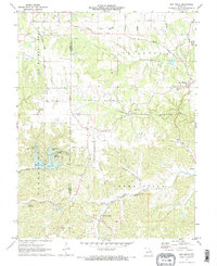
1972 Map of New Melle
USGS Topo · Published 1973About this map
The Emmaus Sanitarium and the settlement of Femme Osage anchor the southern reaches of this landscape, situated near the winding Femme Osage Creek. This 1970s survey captures a distinct mix of rural tradition and mid-century recreation, particularly around the Sherwood Lake development. A cluster of smaller water bodies, including Lake Robin Hood, Sugar Hollow Lake, and Lake Eleanor, illustrates a transition toward residential lakeside planning.
Find a feature on this map
30 named features on this map. Tap any name to fly to it.
Don’t see what you’re looking for? This feature index may not catch every label — zoom into the map to look around manually.
Map Details
Editions of this 1972 New Melle Map
2 editions found
Other maps of this area

1890 · Hermann
USGS Topo · 1:125,000

1903 · O'Fallon
USGS Topo · 1:125,000

1941 · Troy
USGS Topo · 1:62,500

1943 · Warrenton
USGS Topo · 1:62,500

1945 · Troy
USGS Topo · 1:62,500

1945 · Warrenton
USGS Topo · 1:62,500

1948 · Washington
USGS Topo · 1:62,500

1948 · Augusta
USGS Topo · 1:62,500

1949 · Saint Louis
USGS Topo · 1:250,000
1949 · Washington
USGS Topo · 1:62,500