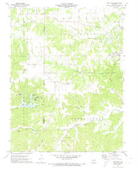
1972 Map of New Melle
USGS Topo · Published 1973About this map
New Melle and the surrounding agricultural valleys of St. Charles and Warren counties are captured here in the early 1970s. The landscape is defined by the winding paths of Dardenne Creek and Femme Osage Creek, with small settlements like Cappeln and Femme Osage serving as local hubs. This era shows a transition toward recreational development, evidenced by the cluster of lakes such as Lake Sherwood, Lake Robin Hood, and Lake Alan.
Find a feature on this map
36 named features on this map. Tap any name to fly to it.
Don’t see what you’re looking for? This feature index may not catch every label — zoom into the map to look around manually.
Map Details
Editions of this 1972 New Melle Map
2 editions found
Other maps of this area

1890 · Hermann
USGS Topo · 1:125,000

1903 · O'Fallon
USGS Topo · 1:125,000

1941 · Troy
USGS Topo · 1:62,500

1943 · Warrenton
USGS Topo · 1:62,500

1945 · Troy
USGS Topo · 1:62,500

1945 · Warrenton
USGS Topo · 1:62,500

1948 · Washington
USGS Topo · 1:62,500

1948 · Augusta
USGS Topo · 1:62,500

1949 · Saint Louis
USGS Topo · 1:250,000
1949 · Washington
USGS Topo · 1:62,500