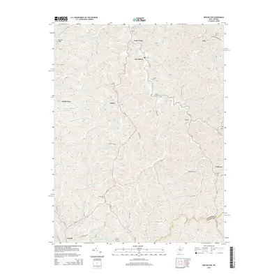
2014 Map of New Milton
USGS Topo · Published 2014About this map
The Meathouse Fork and its complex network of tributaries define the settlement patterns of this West Virginia landscape, where small communities like New Milton and Market are situated along the winding valley floors. This 2014 survey reveals a region deeply rooted in local lineage, evidenced by the high density of family and community burial grounds including Childers Cem, Mid Island Cem, and Snider Cem. The terrain is marked by numerous forks and runs, such as Toms Fork and Lick Run, which have historically dictated the placement of homesteads and rural roads. Transportation is centered on routes like WV-18 and a web of county roads that navigate the ridges and hollows, connecting smaller locales like Leopold and Avon. A notable modern landmark, Nicholson Airport, sits on a high point above the Indian Fork, contrasting with the more traditional land uses of the surrounding timbered hills.
Find a feature on this map
85 named features on this map. Tap any name to fly to it.
Don’t see what you’re looking for? This feature index may not catch every label — zoom into the map to look around manually.
Map Details
Editions of this 2014 New Milton Map
This is the sole edition of this map. No revisions or reprints were ever made.
Other maps of this area

1904 · Vadis
USGS Topo · 1:62,500

1905 · Centerpoint
USGS Topo · 1:62,500

1905 · West Union
USGS Topo · 1:62,500

1906 · Holbrook
USGS Topo · 1:62,500

1924 · Centerpoint
USGS Topo · 1:62,500

1924 · West Union
USGS Topo · 1:62,500

1924 · Holbrook
USGS Topo · 1:62,500

1925 · Centerpoint
USGS Topo · 1:62,500

1925 · Vadis
USGS Topo · 1:62,500

1926 · Holbrook
USGS Topo · 1:62,500