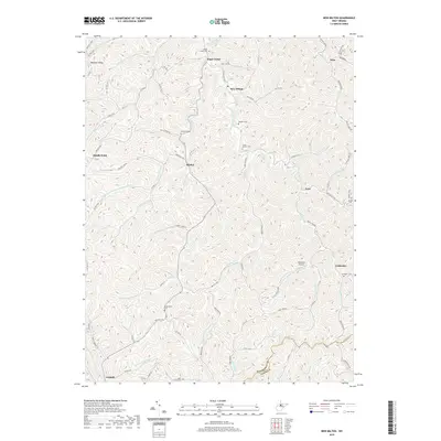
2019 Map of New Milton
USGS Topo · Published 2019About this map
New Milton and the surrounding central West Virginia countryside appear here in a modern survey that highlights the deep-rooted settlement patterns of the Meathouse Fork and Toms Fork valleys. The landscape is defined by its intricate drainage networks and high ridges like Maxwell Ridge, which have historically dictated the placement of small communities and family burial grounds. Local history is preserved in the numerous cemeteries throughout the hills, including Sugarcamp Run Middle Island Cem, Childers Cem, and the Union Mission Cem. Evidence of rural infrastructure is found at Nicholson Airport and along the winding roads that follow the contours of the terrain, such as Porto Rico Rd and Willis Store Rd. From the hamlet of Market to the small cluster at Coldwater, this map documents the persistent identity of these Appalachian hollows and the enduring geography of the Doddridge and Lewis county line.
Find a feature on this map
85 named features on this map. Tap any name to fly to it.
Don’t see what you’re looking for? This feature index may not catch every label — zoom into the map to look around manually.
Map Details
Editions of this 2019 New Milton Map
This is the sole edition of this map. No revisions or reprints were ever made.
Other maps of this area

1904 · Vadis
USGS Topo · 1:62,500

1905 · Centerpoint
USGS Topo · 1:62,500

1905 · West Union
USGS Topo · 1:62,500

1906 · Holbrook
USGS Topo · 1:62,500

1924 · Centerpoint
USGS Topo · 1:62,500

1924 · West Union
USGS Topo · 1:62,500

1924 · Holbrook
USGS Topo · 1:62,500

1925 · Centerpoint
USGS Topo · 1:62,500

1925 · Vadis
USGS Topo · 1:62,500

1926 · Holbrook
USGS Topo · 1:62,500