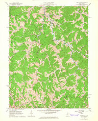
1965 Map of New Milton
USGS Topo · Published 1966About this map
New Milton serves as a central hub in this mid-1960s portrait of north-central West Virginia, where the winding waters of Meathouse Fork and Middle Island Creek dictate the layout of rural life. The landscape is defined by its social infrastructure, featuring local landmarks like Middle Island Sch and the Locust Grove Ch. Small communities such as Middle Point, Market, and Avon are connected by narrow roads and jeep trails that follow the deep valleys of Wolfpen Run and Redlick Run.
Find a feature on this map
46 named features on this map. Tap any name to fly to it.
Don’t see what you’re looking for? This feature index may not catch every label — zoom into the map to look around manually.
Map Details
Editions of this 1965 New Milton Map
2 editions found
Other maps of this area

1904 · Vadis
USGS Topo · 1:62,500

1905 · Centerpoint
USGS Topo · 1:62,500

1905 · West Union
USGS Topo · 1:62,500

1906 · Holbrook
USGS Topo · 1:62,500

1924 · Centerpoint
USGS Topo · 1:62,500

1924 · West Union
USGS Topo · 1:62,500

1924 · Holbrook
USGS Topo · 1:62,500

1925 · Centerpoint
USGS Topo · 1:62,500

1925 · Vadis
USGS Topo · 1:62,500

1926 · Holbrook
USGS Topo · 1:62,500