
1932 Map of New Orleans SE
USGS Topo · Published 1932About this map
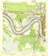
The Mississippi River defines the eastern edge of this coastal landscape, where the river's levees meet an intricate system of canals and bayous in southern Jefferson Parish and Plaquemines Parish. During the early 1930s, the region was characterized by its riverfront settlements like Bertrandville and Oakville, while the interior marshes were increasingly pierced by industrial projects like the Harvey Intracoastal Waterway Canal. Aviation history is present at the Wedell-Williams Landing Field, positioned near the Industry Canal and the Louisiana Southern RR. The map captures the complex drainage and transportation network of the era, from the Wagoner Bridge spanning Bayou Barataria to the numerous irrigation and drainage channels such as the Concord Canal and Augusta Canal. This detailed survey reflects the transition of the Louisiana wetlands as traditional water routes like Bayou des Familles were augmented by modern engineering, including a prominent Pumping Station.
Find a feature on this map
37 named features on this map. Tap any name to fly to it.
Don’t see what you’re looking for? This feature index may not catch every label — zoom into the map to look around manually.
Map Details
Editions of this 1932 New Orleans SE Map
This is the sole edition of this map. No revisions or reprints were ever made.
Other maps of this area

1891 · Pointe a La Hache
USGS Topo · 1:62,500

1891 · New Orleans
USGS Topo · 1:62,500

1892 · Barataria
USGS Topo · 1:62,500

1892 · St. Bernard
USGS Topo · 1:62,500

1892 · Pointe a La Hache
USGS Topo · 1:62,500

1932 · New Orleans NE
USGS Topo · 1:31,680

1932 · New Orleans NW
USGS Topo · 1:31,680

1932 · New Orleans SW
USGS Topo · 1:31,680
1938 · New Orleans West
USGS Topo · 1:31,680
1939 · New Orleans East
USGS Topo · 1:31,680