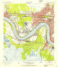
1951 Map of New Orleans West
USGS Topo · Published 1953About this map
The Mississippi River creates a massive oxbow curve that dominates this 1951 mid-century view of Jefferson Parish, carving past Ninemile Pt and Twelvemile Pt. The landscape is a study in early suburban development and vital transit corridors, featuring the massive Moisant Airport in the northwest and the sprawling rail yards of Plauche. The industrial and transportation backbone of the region is evident in the dense concentration of rail lines, including the Illinois Central Railroad and the Texas and Pacific Railway, which converge near the monumental Huey P Long Bridge.
Find a feature on this map
45 named features on this map. Tap any name to fly to it.
Don’t see what you’re looking for? This feature index may not catch every label — zoom into the map to look around manually.
Map Details
Editions of this 1951 New Orleans West Map
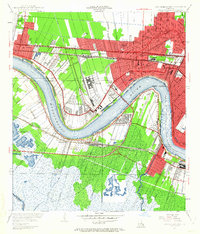
2 editions found
Other maps of this area

1891 · Hahnville
USGS Topo · 1:62,500

1891 · Spanish Fort
USGS Topo · 1:62,500

1891 · New Orleans
USGS Topo · 1:62,500

1892 · Bonnet Carre
USGS Topo · 1:62,500

1932 · New Orleans NE
USGS Topo · 1:31,680

1932 · New Orleans NW
USGS Topo · 1:31,680

1932 · New Orleans SE
USGS Topo · 1:31,680

1932 · New Orleans SW
USGS Topo · 1:31,680

1932 · Hahnville NE
USGS Topo · 1:31,680

1935 · Luling
USGS Topo · 1:31,680