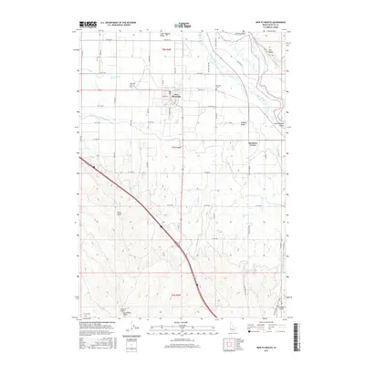
2017 Map of New Plymouth
USGS Topo · Published 2017About this map
New Plymouth anchors the northern portion of this map, positioned where the Lower Payette Valley meets an intricate network of irrigation infrastructure. This 2017 survey details the intensive water management of the region, featuring the Noble Canal, Farmers Cooperative Canal, and the A Line Canal which navigate the terrain alongside the winding Payette River. To the east, the landscape transitions at The Bluffs and Birding Island, while the southern reaches are marked by more dissected topography including Hurd Gulch and Ashlock Gulch. For local historians and genealogists, the map provides precise locations for Parkview Cem and Kennedy Cem, as well as the outlying settlement at Hamilton Corner. The orderly grid of county roads, such as S Plymouth Ave and Sand Hollow Rd, reflects the agricultural heritage and sustained development of Payette County's irrigation districts.
Find a feature on this map
56 named features on this map. Tap any name to fly to it.
Don’t see what you’re looking for? This feature index may not catch every label — zoom into the map to look around manually.
Map Details
Editions of this 2017 New Plymouth Map
This is the sole edition of this map. No revisions or reprints were ever made.
Other maps of this area

1897 · Weiser
USGS Topo · 1:125,000

1898 · Nampa
USGS Topo · 1:125,000

1951 · Payette
USGS Topo · 1:24,000

1952 · Birding Island
USGS Topo · 1:24,000

1955 · Baker
USGS Topo · 1:250,000

1955 · Boise
USGS Topo · 1:250,000

1958 · Boise
USGS Topo · 1:250,000

1959 · Baker
USGS Topo · 1:250,000

1962 · Boise
USGS Topo · 1:250,000
1965 · Nyssa
USGS Topo · 1:24,000