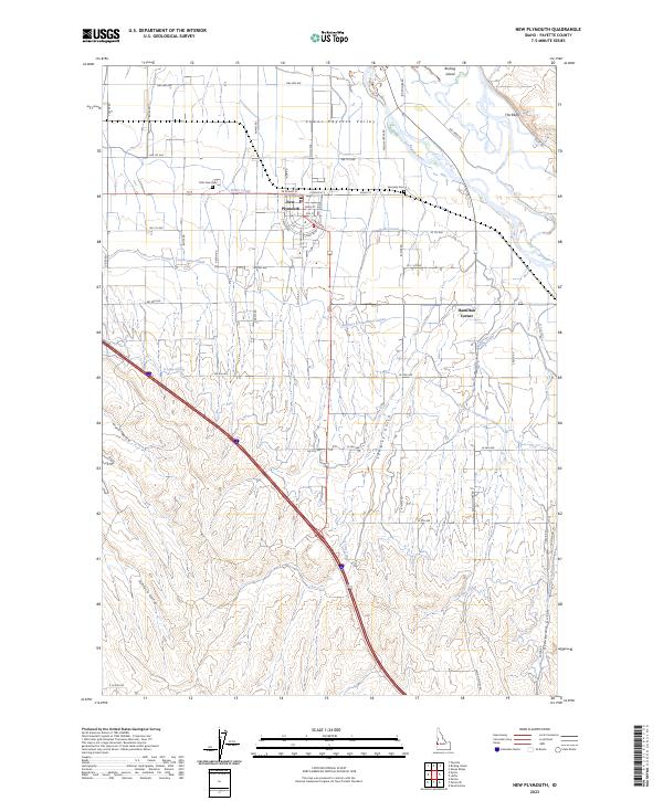
2023 Map of New Plymouth
USGS Topo · Published 2023About this map
New Plymouth stands at the center of this 2023 survey, revealing the intricate irrigation network that supports the Lower Payette Valley. This landscape is defined by its engineering, with the Noble Canal, A Line Canal, and Farmers Cooperative Canal cutting across the terrain to sustain local agriculture. The northern edge is bounded by the Payette River, where riparian features like Birding Island and The Bluffs provide a natural contrast to the grid-based settlement pattern. For local historians, the inclusion of Park View Cem and Kennedy Cem offers specific points of interest for genealogical research. Further south, the map details several named drainages, including Hurd Gulch, Ashlock Gulch, and the curiously named Graveyard Gulch, which contribute to the distinct topography of this agricultural region near Hamilton Corner.
Find a feature on this map
65 named features on this map. Tap any name to fly to it.
Don’t see what you’re looking for? This feature index may not catch every label — zoom into the map to look around manually.
Map Details
Editions of this 2023 New Plymouth Map
This is the sole edition of this map. No revisions or reprints were ever made.
Other maps of this area

1897 · Weiser
USGS Topo · 1:125,000

1898 · Nampa
USGS Topo · 1:125,000

1951 · Payette
USGS Topo · 1:24,000

1952 · Birding Island
USGS Topo · 1:24,000

1955 · Baker
USGS Topo · 1:250,000

1955 · Boise
USGS Topo · 1:250,000

1958 · Boise
USGS Topo · 1:250,000

1959 · Baker
USGS Topo · 1:250,000

1962 · Boise
USGS Topo · 1:250,000
1965 · Nyssa
USGS Topo · 1:24,000