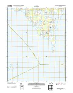
2013 Map of New Point Comfort
USGS Topo · Published 2013About this map
New Point Comfort Lighthouse stands at the southern tip of this coastal survey, marking the entrance to the Chesapeake Bay from the Mobjack Bay area. The landscape is defined by its low-lying fingers of land separated by tidal inlets, where small settlements like Bavon, Shadow, and Susan are connected by narrow state routes. The shoreline is punctuated by local maritime landmarks including New Point Wharf and Diggs Wharf, illustrating a community long dependent on the water for transport and trade.
Find a feature on this map
52 named features on this map. Tap any name to fly to it.
Don’t see what you’re looking for? This feature index may not catch every label — zoom into the map to look around manually.
Map Details
Editions of this 2013 New Point Comfort Map
This is the sole edition of this map. No revisions or reprints were ever made.
Other maps of this area

1907 · Hampton
USGS Topo · 1:62,500

1916 · Mathews
USGS Topo · 1:62,500

1917 · Mathews
USGS Topo · 1:62,500

1943 · Richmond
USGS Topo · 1:250,000

1944 · Messick
USGS Topo · 1:24,000

1944 · Harris Grove
USGS Topo · 1:24,000

1948 · Ware Neck
USGS Topo · 1:24,000

1948 · Achilles
USGS Topo · 1:24,000

1948 · New Point Comfort
USGS Topo · 1:24,000

1948 · Mathews
USGS Topo · 1:24,000