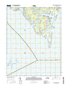
2016 Map of New Point Comfort
USGS Topo · Published 2016About this map
Chesapeake Bay and Mobjack Bay define the peninsular character of this coastal Virginia landscape. The geography is marked by numerous family-named burial sites and small settlements including Bavon, Shadow, and Susan. Small hamlets are concentrated on the narrow necks of land between tidal inlets like Horn Harbor. The density of specific family markers, such as the Hudgins Burial Ground, Armistead Burial Ground, and Jarvis Burial Ground, provides significant value for genealogical research in this part of Mathews County. The southern tip terminates at New Point Comfort, while the western edge reaches the Guinea Marshes and Big Island. Local infrastructure is characterized by winding coastal roads like Bayside Dr and Hunts Rd, which connect the scattered communities across the low-lying terrain.
Find a feature on this map
82 named features on this map. Tap any name to fly to it.
Don’t see what you’re looking for? This feature index may not catch every label — zoom into the map to look around manually.
Map Details
Editions of this 2016 New Point Comfort Map
This is the sole edition of this map. No revisions or reprints were ever made.
Other maps of this area

1907 · Hampton
USGS Topo · 1:62,500

1916 · Mathews
USGS Topo · 1:62,500

1917 · Mathews
USGS Topo · 1:62,500

1943 · Richmond
USGS Topo · 1:250,000

1944 · Messick
USGS Topo · 1:24,000

1944 · Harris Grove
USGS Topo · 1:24,000

1948 · Ware Neck
USGS Topo · 1:24,000

1948 · Achilles
USGS Topo · 1:24,000

1948 · New Point Comfort
USGS Topo · 1:24,000

1948 · Mathews
USGS Topo · 1:24,000