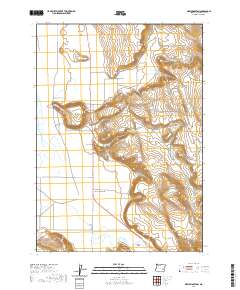
2020 Map of New Princeton
USGS Topo · Published 2020About this map
New Princeton anchors this high-desert landscape in Harney County, where the transition from flat valley floors to volcanic rimrocks is marked by features like Windy Point and Pelican Point. The mapping of this corner of southeastern Oregon reflects a sparsely populated area defined by large-scale ranching and land management, with roads like Crane Blvd and Lava Bed Rd providing the primary connectivity across the vast township lines. Local history is anchored at the Windy Point Cem, a small landmark overlooking the surrounding terrain.
Find a feature on this map
23 named features on this map. Tap any name to fly to it.
Don’t see what you’re looking for? This feature index may not catch every label — zoom into the map to look around manually.
Map Details
Editions of this 2020 New Princeton Map
This is the sole edition of this map. No revisions or reprints were ever made.
Other maps of this area

1955 · Burns
USGS Topo · 1:250,000

1958 · Burns
USGS Topo · 1:250,000

1959 · Burns
USGS Topo · 1:250,000

1960 · Crane
USGS Topo · 1:62,500

1967 · Barton Lake
USGS Topo · 1:24,000

1967 · Adobe Flat
USGS Topo · 1:24,000

1968 · Venator
USGS Topo · 1:62,500

1972 · Circle Bar
USGS Topo · 1:24,000
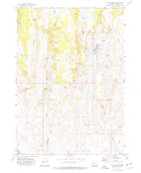
1972 · Tin Can Ridge
USGS Topo · 1:24,000

1974 · Anderson Mtn
USGS Topo · 1:62,500