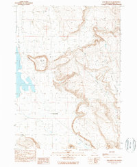
1990 Map of New Princeton
USGS Topo · Published 1990About this map
New Princeton and its local post office serve as the primary human landmark in this section of the Harney Valley, documented during a 1980s field check. The landscape is defined by the sharp contrast between the flat valley floor and the elevated plateau of the Beaver Tables to the east. Transportation and settlement patterns follow the base of these heights, where the Windy Point Cem sits near the base of the prominent Windy Point.
Find a feature on this map
8 named features on this map. Tap any name to fly to it.
Don’t see what you’re looking for? This feature index may not catch every label — zoom into the map to look around manually.
Map Details
Editions of this 1990 New Princeton Map
This is the sole edition of this map. No revisions or reprints were ever made.
Other maps of this area

1955 · Burns
USGS Topo · 1:250,000

1958 · Burns
USGS Topo · 1:250,000

1959 · Burns
USGS Topo · 1:250,000

1960 · Crane
USGS Topo · 1:62,500

1967 · Barton Lake
USGS Topo · 1:24,000

1967 · Adobe Flat
USGS Topo · 1:24,000

1968 · Venator
USGS Topo · 1:62,500

1972 · Circle Bar
USGS Topo · 1:24,000
1972 · Tin Can Ridge
USGS Topo · 1:24,000

1974 · Anderson Mtn
USGS Topo · 1:62,500