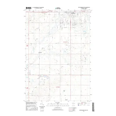
2015 Map of New Richmond South
USGS Topo · Published 2015About this map
New Richmond occupies the northern edge of this landscape, situated where the Willow River meets the New Richmond Flowage 146. This 2015 study captures the agrarian character of Saint Croix County, where established town centers like Roberts and Boardman are connected by a network of county roads. The terrain is marked by distinct glacial hydrology, featuring multiple spring-fed sites such as Anderson Springs and Hennessey Spring, along with varied water bodies like Brushy Mound Lake and Three Lakes. For those tracing local heritage, the map identifies the Immaculate Conception Catholic Church and the Boardman Cem, while the Rusmar Farms Airport highlights the mix of traditional farming and modern aviation infrastructure. Small tributaries like Paperjack Cr and Tenmile Cr weave through the township divisions, illustrating the historical drainage patterns that have shaped the region's agricultural development.
Find a feature on this map
125 named features on this map. Tap any name to fly to it.
Don’t see what you’re looking for? This feature index may not catch every label — zoom into the map to look around manually.
Map Details
Editions of this 2015 New Richmond South Map
This is the sole edition of this map. No revisions or reprints were ever made.
Other maps of this area

1946 · River Falls
USGS Topo · 1:62,500

1948 · New Richmond
USGS Topo · 1:62,500

1949 · New Richmond
USGS Topo · 1:62,500

1949 · River Falls
USGS Topo · 1:62,500

1949 · Baldwin
USGS Topo · 1:62,500

1950 · Deer Park
USGS Topo · 1:62,500

1953 · Saint Paul
USGS Topo · 1:250,000

1953 · Stillwater
USGS Topo · 1:250,000

1955 · Stillwater
USGS Topo · 1:250,000

1958 · Stillwater
USGS Topo · 1:250,000