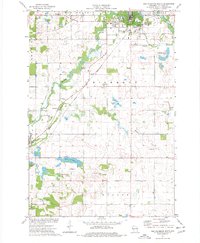
1974 Map of New Richmond South
USGS Topo · Published 1977About this map
New Richmond anchors the northern edge of this St. Croix County landscape, where the Willow River and Paperjack Creek converge amidst a mix of agricultural plots and light industry. The 1970s character of the town is evident in the presence of the High School and the nearby Cemetery, while the Chicago and North Western rail line cuts diagonally through the townships of Star Prairie and Richmond.
Find a feature on this map
32 named features on this map. Tap any name to fly to it.
Don’t see what you’re looking for? This feature index may not catch every label — zoom into the map to look around manually.
Map Details
Editions of this 1974 New Richmond South Map
This is the sole edition of this map. No revisions or reprints were ever made.
Other maps of this area

1946 · River Falls
USGS Topo · 1:62,500

1948 · New Richmond
USGS Topo · 1:62,500

1949 · New Richmond
USGS Topo · 1:62,500

1949 · River Falls
USGS Topo · 1:62,500

1949 · Baldwin
USGS Topo · 1:62,500

1950 · Deer Park
USGS Topo · 1:62,500

1953 · Saint Paul
USGS Topo · 1:250,000

1953 · Stillwater
USGS Topo · 1:250,000

1955 · Stillwater
USGS Topo · 1:250,000

1958 · Stillwater
USGS Topo · 1:250,000