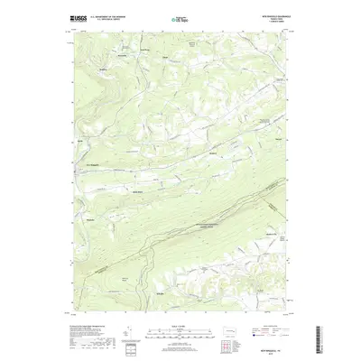
2019 Map of New Ringgold
USGS Topo · Published 2019About this map
New Ringgold and the surrounding townships in Schuylkill County sit at a significant geographical and cultural junction where the Little Schuylkill River carves through the Appalachian ridges. This landscape is defined by its deep religious and community roots, evidenced by the numerous burial grounds such as Zion United Methodist Cem and the West Penn German Eldership of the Church of God Cem. The terrain includes the notable River of Rocks, a distinctive geological feature south of the Appalachian National Scenic Trail which traverses the ridgeline along the border with Berks and Lehigh counties.
Find a feature on this map
88 named features on this map. Tap any name to fly to it.
Don’t see what you’re looking for? This feature index may not catch every label — zoom into the map to look around manually.
Map Details
Editions of this 2019 New Ringgold Map
This is the sole edition of this map. No revisions or reprints were ever made.
Other maps of this area

1889 · Hazleton
USGS Topo · 1:62,500

1889 · Pottsville
USGS Topo · 1:62,500

1891 · Hazleton
USGS Topo · 1:62,500

1891 · Pottsville
USGS Topo · 1:62,500

1892 · Mahanoy
USGS Topo · 1:62,500

1893 · Hazleton
USGS Topo · 1:62,500

1893 · Mahanoy
USGS Topo · 1:62,500

1909 · Hamburg
USGS Topo · 1:62,500

1911 · Hamburg
USGS Topo · 1:62,500

1944 · Orwigsburg
USGS Topo · 1:24,000
Featured Places
- West Penn Township, PA
- Albany Township, PA
- New Ringgold, PA
- Windsor Township, PA
- Clamtown, West Penn Township